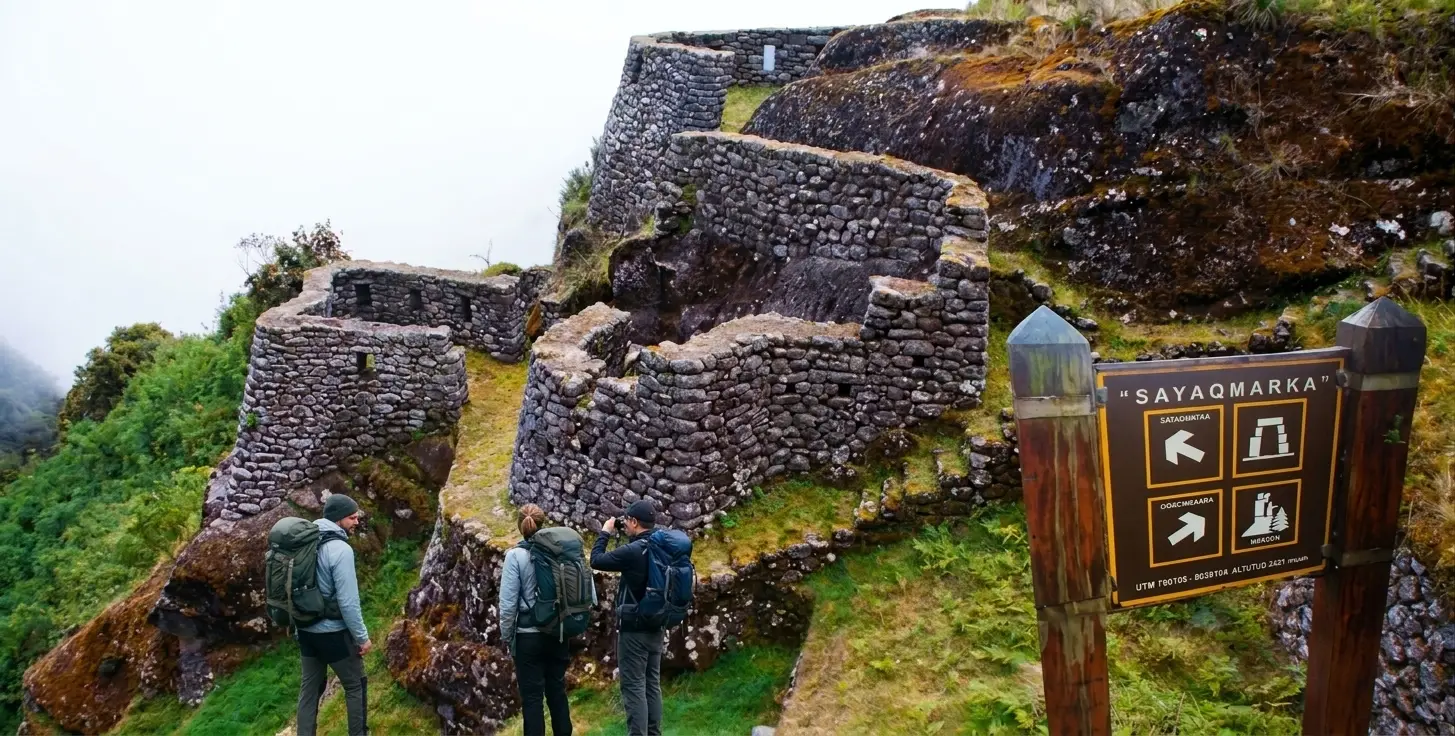
Sayacmarca on the Inca Trail is one of the most strategic and best-preserved points on the route to Machu Picchu. This archaeological site is located in a rocky area that is difficult to access. However, it offers a unique perspective on the territorial control and hydraulic engineering of the Incas. For most hikers, this site represents one of the most memorable moments of the third day of trekking. Not only for its architecture, but also for the natural environment that surrounds it. At Trails to Machu Picchu, our team of professional guides will help you discover this beautiful archaeological site in a safe and fun way.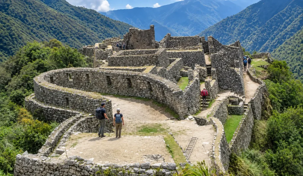
- Meaning of Sayacmarca in Quechua
- Location of the Sayacmarca Archaeological Site
- The Third Day of Trekking to Machu Picchu
- Inca Architecture in Sayacmarca
- Stone Stairs of Sayacmarca
- Historical Importance and Military Function
- Water Channel System in Sayacmarca
- Weather in the Sayacmarca Area
- Recommendations for Travelers
- Preservation and Respect for Heritage
Meaning of Sayacmarca in Quechua
The name of the site comes from two Quechua words: Saya, which means “upright” or “standing”, and Marka, which means “town”, “city”, or “village”. Therefore, the meaning of Sayacmarca is usually interpreted as “Town in a Steep Place” or “Dominant Town”. This designation is extremely precise, as the cluster of buildings seems to sprout directly from the edge of a mountain, showcasing dominance over the surrounding ravines.
Some historians suggest that the original name of the site may have been different during the Inca occupation period. However, the current name faithfully reflects its most evident characteristic: its vertical position and apparent inexpugnability. When you visit this place, you quickly understand why the builders chose this rocky outcrop to establish a permanent settlement.
Location of the Sayacmarca Archaeological Site
The location of the Sayacmarca archaeological site is at an altitude of approximately 3,600 meters above sea level. It is situated within the Historic Sanctuary of Machu Picchu, specifically on the slope of the Vilcabamba mountain range. Geographically, the site marks an important transition zone where the Andean ecosystem begins to intertwine with the cloud forest or high jungle boundary.
From its terraces, the Aobamba valley can be seen from Sayacmarca, a deep basin that flows toward the Vilcanota River. This location was not accidental. It allowed the Incas to monitor the movement of people and goods coming up from the Amazonian regions toward the imperial capital of Cusco. The complex sits on a small area, optimizing every available square meter through solid retaining walls.
The Third Day of Trekking to Machu Picchu
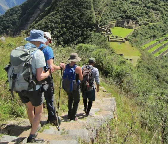
The visit to this site takes place during the third day of the four-day Inca Trail. This day is usually the longest in distance, but also the richest in archaeological discoveries. Travelers leave early from Pacaymayo, cross the Runkurakay pass, and descend toward the complex.
The trek from Chaquicocha to Sayacmarca is a short but physically demanding stretch due to the steepness of the terrain. Chaquicocha, whose name means “dry lagoon”, is usually the place where hiking groups stop for lunch before undertaking the final ascent to the ruins of Sayacmarca. This section of the route is characterized by narrow trails and a noticeable change in vegetation, which becomes denser and more humid.
Inca Architecture in Sayacmarca
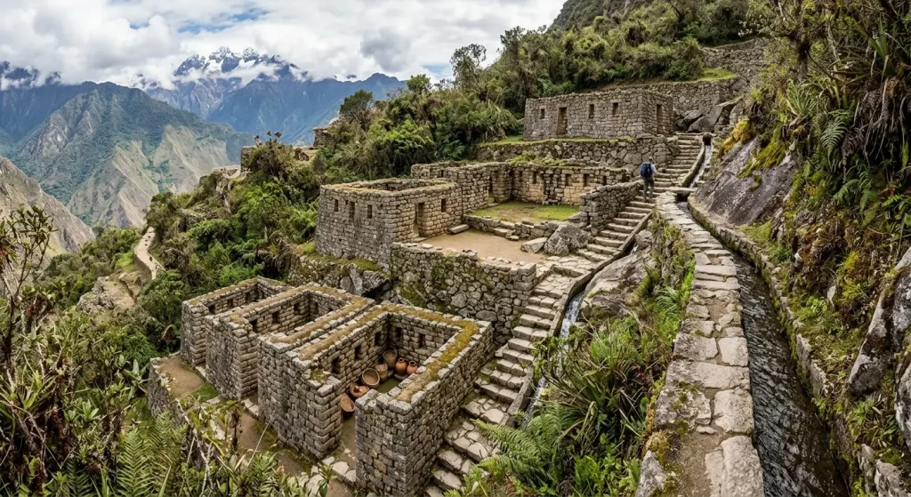
The Inca architecture in Sayacmarca stands out for its adaptation to the irregular topography. The site is mainly divided into two sectors: a ceremonial one and a residential or storage one. The walls, built with finely carved stones, are solid and have endured centuries of humidity.
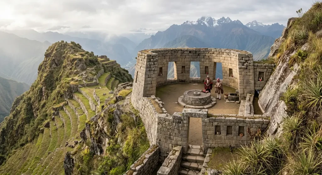
A distinctive feature is the circular structures of Sayacmarca. Unlike many other Inca settlements that favor rectangular layouts, here you can find curved enclosures that conform to the contours of the rock outcrop. These spaces may have served ritual functions related to astronomical observation or the veneration of the surrounding mountains.
- Dwellings: Small rooms with wall niches for placing objects.
- Central Plaza: A small open space connecting the different levels of the site.
- Storehouses: Structures intended for storing supplies for travelers and guards.
Stone Stairs of Sayacmarca
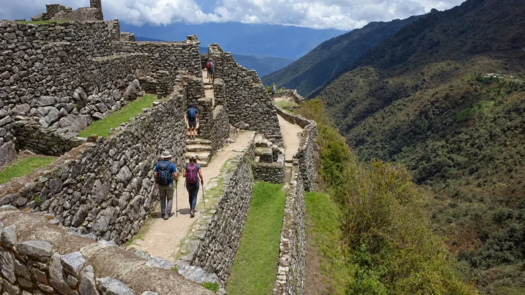
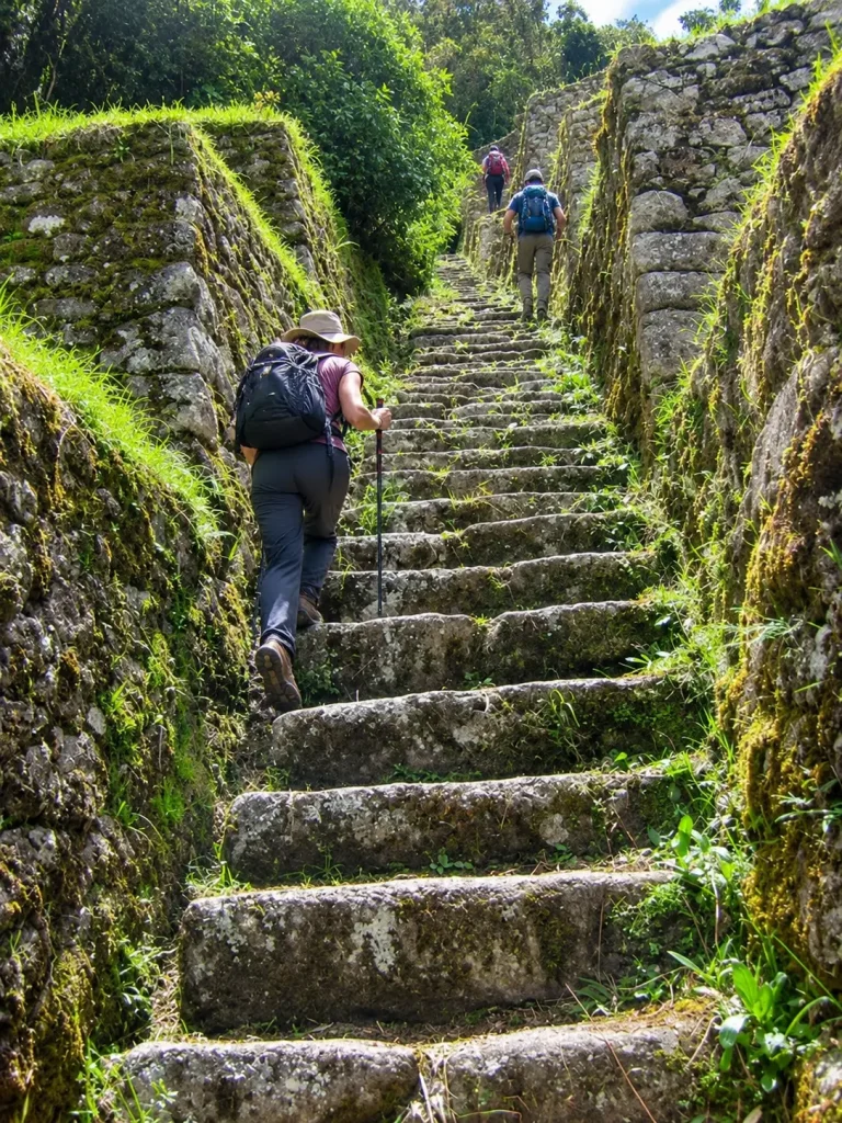
Accessing the complex is one of the most exciting and challenging parts of the visit. The stone stairs of Sayacmarca are famous for being steep and narrow. There are nearly a hundred steps carved or placed with great skill. These stairs lead directly to the main entrance of the site. The climb requires care and a steady pace, but the effort is rewarded upon crossing the stone threshold.
These stairs not only served a practical access function, but were also part of the site’s defense system. A small group of soldiers could easily guard the entrance due to the narrowness of the path. Today, these steps are a testimony to the durability of the roads built by the engineers of Tahuantinsuyo.
Historical Importance and Military Function
The historical importance of Sayacmarca lies in its role as an administrative and religious checkpoint. It was not a densely populated city, but rather a strategic location to monitor the routes between the Sacred Valley and the high jungle. It is believed to have been a tambo where the passage of valuable goods such as coca, exotic feathers, and medicinal plants was controlled.
The military function of Sayacmarca is evident when analyzing its view over the surrounding valleys. From its lookouts, quick warnings could be given regarding any unusual movement in the territory. Furthermore, its proximity to other sites like Phuyupatamarca and Runkurakay suggests it was part of a visual communications network using smoke signals or mirrors during the day.
Water Channel System in Sayacmarca
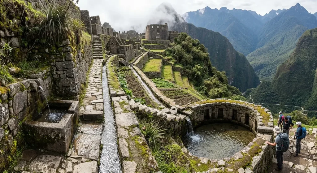
Despite its location atop a cliff, the Incas managed to implement a sophisticated water channel system in Sayacmarca. Water was transported from nearby springs through finely carved rock channels. These channels fed liturgical fountains or baths that had a ritual purification function for travelers heading toward the sacred city of Machu Picchu.
The water management at this site demonstrates a profound knowledge of hydraulics. Even under heavy rains, the drainage design prevented soil erosion around the foundations and maintained the stability of the structures. Observing how water still flows today through some of these channels allows visitors to appreciate the connection of the Incas with natural elements.
Weather in the Sayacmarca Area
The weather in the Sayacmarca area is highly variable due to its altitude and proximity to the high jungle. Visitors should be prepared for changing conditions within minutes. In the mornings, fog commonly covers the ruins completely, giving them a mysterious atmosphere that dissipates as the sun warms up.
Rains are frequent, especially between the months of November and March. However, even in the dry season (May to September), light drizzles can occur in the afternoon. It is recommended to wear good quality waterproof clothing and dress in layers to adapt to temperature changes between the physical effort of hiking and rest moments at the site.
Recommendations for Travelers
When planning your visit to Sayacmarca on the Inca Trail, it is essential to consider some practical aspects that will enhance your experience. Due to the site’s fragility and narrow passages, you must walk carefully and show respect for the original structures.
- Hiking pace: Do not try to rush up the stairs; the altitude can affect your breathing.
- Photography: The best moments to capture the architecture are when clouds shift, revealing the Aobamba valley.
- Specialized guide: Having a professional guide, such as those provided by our company Trails to Machu Picchu, helps you understand historical details that might go unnoticed at first glance.
- Gear: Wear footwear with good grip, as the stone stairs can be slippery due to moisture.
This site is one of the archaeological sites before Phuyupatamarca that best illustrates the transition to the jungle. Upon leaving, the trail continues through a cloud forest filled with orchids, ferns, and mosses. All of this offers a fascinating natural contrast to the gray stone of the buildings.
Preservation and Respect for Heritage
As part of any field guide for the Inca Trail, it is vital to remember that Sayacmarca is a protected area governed by the Ministry of Culture of Peru. Climbing on the walls or removing any material from the site, whether stone or vegetation, is strictly prohibited. The conservation of this place directly depends on the responsible behavior of every visitor.
Visiting Sayacmarca on the Inca Trail is not just a technical stop on the route to the wonder of the world. It is an opportunity to reflect on the human ability to inhabit remote places in harmony with geography. The feeling of being suspended over the valley, surrounded by clouds and centuries-old walls, is one of the most authentic experiences that Peru offers to those who choose to hike its ancestral trails.
The stay at this site usually lasts about 30 to 45 minutes. This time is sufficient to explore its corridors, observe its fountains, and take in the vastness of the landscape. As you continue toward the next campsite, you will take with you the image of a town that refuses to yield to the passage of time and the gravity of the Andes.
Our team at Trails to Machu Picchu offers you the opportunity to discover and enjoy this archaeological wonder during your Inca Trail journey, contact us.